For the first time in oceanography, the fine-scale landscape of the height of the sea surface is revealed to us.
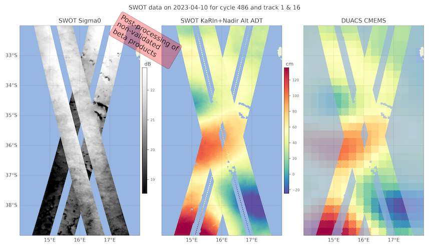
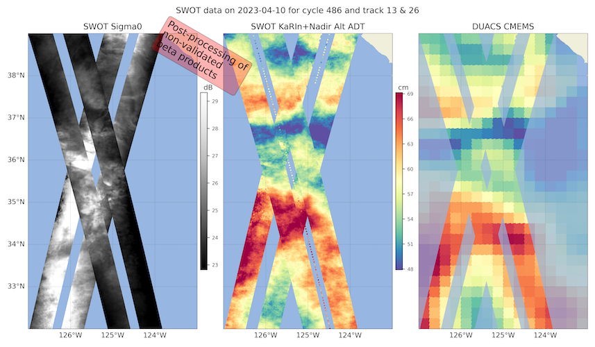
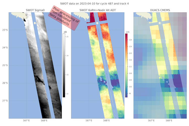
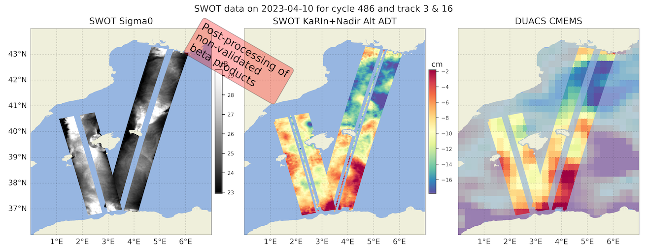
Thanks to the outstanding work of the SWOT project teams, some impressive preliminary images of sea surface height derived from SWOT and sigma0 have already been produced. The images are generated with unvalidated beta products from the SWOT KaRIn instrument to support the AdAC campaigns in their planning strategies.
The SWOT project teams have published some preliminary images of sea surface height and sigma0 derived from SWOT. These images are exclusively for use at our own risk to support the AdAC consortium's in situ sampling strategy and are accompanied by the following disclaimer: "These images were generated by the SWOT project teams with unvalidated beta products from the SWOT KaRIn instrument in support of the AdAC campaigns". The level 2 beta products were post-processed with level 3 multi-sensor algorithms. The quality of the SWOT products is not definitive and is likely to evolve as JPL and CNES progress with the development of the algorithm suite.
According to one of AdAC's PIs, the images are "impressive" and provide "motivation for future fieldwork".
The persistent SSH anomalies visible over several days and the corresponding SST or Chl anomalies are probably reliable, up to scales of 15 to 20 km wavelength! The 'orange peel' patterns could be artefacts due to sub-optimal atmospheric or sea state corrections (to be investigated in the coming months, in line with the nominal Cal/Val schedule). The high-resolution signal from the SWOT maps is consistent with the finer resolution of the AVISO maps.
The CNES and JPL teams are making a considerable effort to support AdAC with these images. The image processing algorithms are not yet at their final stage, and certain stages in the production of the images require time-consuming manual processing specific to the region.
SWOT crossover images are currently being processed in the western Mediterranean, where the BioSWOT-Med campaign starts tomorrow, off California, south of South Africa and south of New Caledonia.
The images are available on the AVISO website.
As one of the executive members of the AdAC SWOT steering group put it: "Savour this historic moment when, for the first time in oceanography, the fine-scale landscape of the height of the sea surface is revealed to us!
Many thanks to the SWOT project teams!
BioSWOT-Med is an international campaign carried out in collaboration with a number of institutions.
The researchers on board the BioSWOT-Med cruise are affiliated to the University of Aix-Marseille, the CNRS, Sorbonne University, the National Museum of Natural History (France), the CNR and the OGS (Italy), the Thünen Institute (Germany), the University of Arizona (USA) and the University of Auckland (New Zealand).
We also collaborate with SHOM, CEA, IFREMER, ULCO, Université Gustave Eiffel (France), CSIC (Spain), SZN (Italy), the University of Bergen (Norway), UCSD, MBARI, NWRA and the University of Washington (USA).
These people work for major oceanography laboratories such as MIO, LOCEAN (France), ISMAR (Italy), IMEDEA, SOCIB (Spain) and SCRIPPS (USA).
More information