


From 25 to 27 April, the Luminy wind tunnel (LASIF-IOA) played host to the St3ART (read 'Street Art') project team, whose aim is to measure surface height using a combination of instruments (acoustic altimeter and micro-LIDAR). The measurements taken in the wind tunnel serve as a calibration bench for these instruments, which will then be installed (1) under a multitude of bridges in order to improve flood forecasting (vigicrues.gouv.fr plan), and (2) on ships, in order to pass under the track of altimeter satellites such as Sentinel-3A and 3B. The quality of the measurements already collected and compared is very encouraging, in terms of the qualification of the instruments. The team is due to return soon, as part of the launch of Sentinel-6 and the future SWOT satellites.
The team: Michel Calzas and Karim Mahiouz (DT-INSU, la Seyne sur mer), Pascal Bonnefond (Astronomer at SYRTE, Paris observatory), Jean-Christophe Poisson (Vortex-IO, Toulouse), Lionel Fichen (DT-INSU, Brest), Olivier Laurain (Geoazur, Sofia-Antipolis), and Jean-Jacques Fourmond (DT-INSU management).
The meticulous preparation of the experiment on the Luminy side and its conduct were ensured thanks to the assistance of Mr Christopher Luneau (OSU-Pytheas), Ms Elpida Vonta (M2 at MIO), Ms Laure Cossalter (M1 at MIO), and Mr Hubert Branger (ex IRPHE, Marseille).
MIO contact: D. Bourras
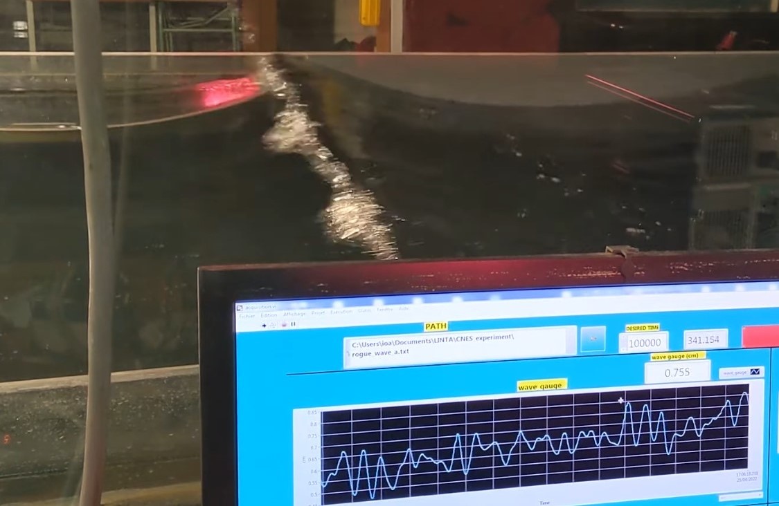
Illustration: generation of a rogue wave (surface waves focused on a point) as it breaks. As it passes, the variations in height of the free surface are recorded by a wave probe, and by remote sensing instruments installed on the roof of the wind tunnel by the company VORTEX_IO, and the DT-INSU of the CNRS, as part of the St3ART project.