
On December 16, 2022, follow the SWOT satellite launch live !
The Franco-American SWOT (Surface Water and Ocean Topography) satellite is scheduled for launch on Friday, December 16, 2022 from Vandenberg Air Force Base in California at 12:46 p.m. CET (3:46 a.m. Pacific Standard Time).
This international CNES and NASA mission will provide high-definition data on fresh and salt water over 90 percent of the Earth's surface. This mission will provide a higher definition view of the Earth's water than ever before. The data obtained by SWOT will be compared with data that will be collected in 2023 during the BioSWOT-Med oceanographic campaign south of the Balearic Islands to try to understand the role of ocean currents in determining the exceptional biodiversity of the Mediterranean.
The Surface Water and Ocean Topography (SWOT) mission will see Earth's freshwater bodies and ocean with higher definition than ever before, providing insight into how the ocean influences climate change, and how global warming affects lakes, rivers and reservoirs.
The first six months of the mission include a calibration and validation (CalVal) phase of the satellite, during which the satellite will fly in a one-day repeat orbit with reduced spatial coverage but improved temporal resolution. During this period, SWOT's ascending and descending trajectories will intersect, providing a higher temporal resolution: the crossovers. These crossovers represent a unique opportunity to track rapidly changing fine-scale ocean dynamics.
"We are looking forward to the launch of SWOT and are very busy with the preparations of our campaign, which are progressing intensively: organizational meetings are taking place to plan the operations, prepare the tools and ship the oceanographic equipment on board the research vessel" says Andrea Doglioli, oceanographer and physicist at the Mediterranean Institute of Oceanography (MIO) in Marseilles, France, and head of mission of the BioSWOT-Med campaign, which will take place from April 20 to May 15, 2023, in the south of the Balearic Islands, in correspondence with one of SWOT's crossovers.
"The new satellite and its new sensors will allow a better accuracy in the measurement of sea surface height, and from this we will be able to improve our estimates of marine currents. With a better mapping of the currents we will be more efficient to sample them and establish the relationships between ocean currents and biological communities" explains Gérald Grégori, microbiologist at the MIO and co-mission leader of the BioSWOT-Med campaign.
The Mediterranean is in fact an oligotrophic sea (with few nutrients), but it harbors one of the greatest biodiversities in the world. One of the objectives of the BioSWOT-Med campaign is to understand the physical processes that structure this biodiversity and that could be the basis of the great diversity of marine organisms, from plankton to cetaceans, observed in the Mare Nostrum.
The BioSWOT-Med campaign is one of the 24 oceanographic and hydrological campaigns already programmed during the rapid sampling phase of SWOT, gathered in the international SWOT-AdAC (Adopt a Crossover) Consortium.
The SWOT mission is a collaboration between CNES and NASA with contributions from the Canadian Space Agency (CSA) and the British Space Agency. The satellite was assembled, integrated and tested at the Thales Alenia Space facility in Cannes, France.
To allow as many people as possible to follow the launch of SWOT, CNES is producing a broadcast on its Twitch and YouTube channels starting at 12:15 p.m.
More information is available on the dedicated CNES website.
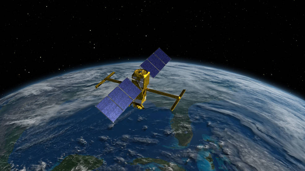
An artist's concept of the SWOT spacecraft. The SWOT mission will measure the height of the world's oceans, rivers and lakes
helping scientists measure changes in fresh and salt water masses over time. Credits: NASA

This illustration shows the SWOT (Surface Water and Ocean Topography) satellite in orbit with its solar panels
and KaRIn instrument antennas deployed. Credits: CNES