The fine scale landscape of sea surface height revealed to our eyes
For the first time in oceanography, the fine scale landscape of sea surface height is revealed to our eyes.
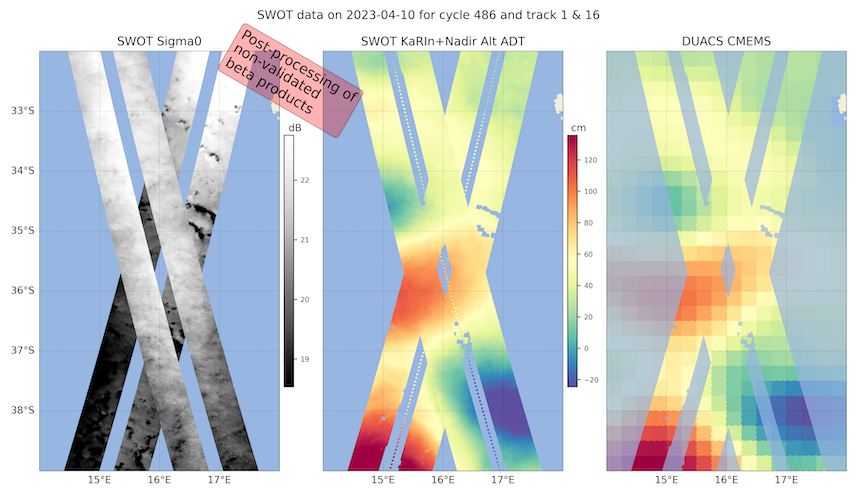
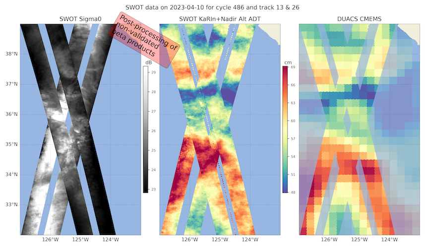
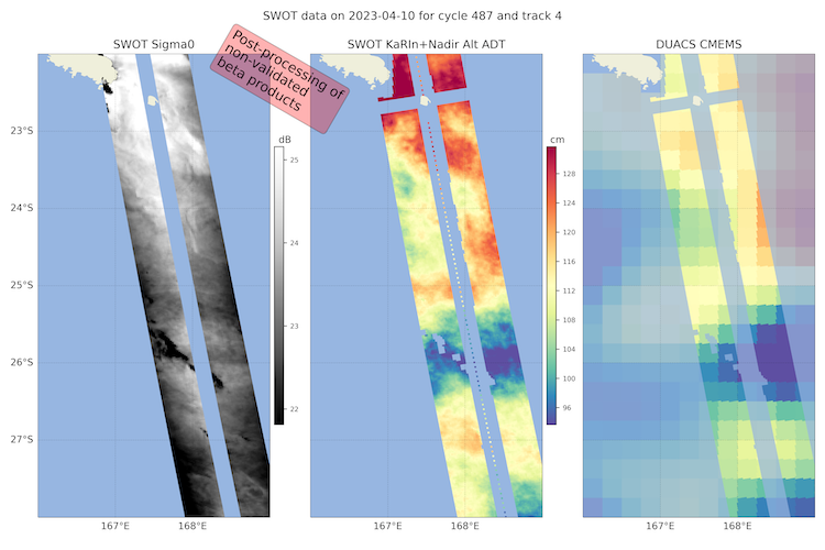
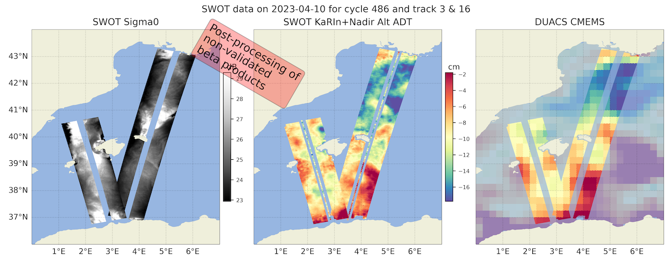
Thanks to an exceptional work of the SWOT Project teams, some preliminary impressive images of SWOT-derived sea surface height and sigma0 are being already produced. The images are generated with non-validated beta products from the SWOT KaRIn instrument in support to AdAC campaigns for their planning strategies.
SWOT Project Teams released some preliminary images of SWOT-derived sea surface height and sigma0. The images are intended exclusively as “use at our own risk” for supporting the in situ sampling strategy of the AdAC Consortium and come with the disclaimer “These images are generated by SWOT Project teams with non-validated beta products from the SWOT KaRIn instrument in support to AdAC campaigns. The beta Level-2 products were post-processed with Level-3 multi-sensor algorithms. SWOT product quality is not final and will likely change as JPL and CNES make progress on the algorithms suite.”
According to one of the AdAC PIs the images are “impressive” and they are a “quite a motivation for the upcoming field work”.
Persistent SSH anomalies visible over multiple days and matching SST or Chl anomalies are likely to be reliable, down to scales of 15-20 km wavelength! “Orange skin” patterns might be artifacts from non-optimal atmospheric or sea state corrections (to be investigated in the coming months, as per the nominal Cal/Val schedule). The high-resolution signal on SWOT maps is coherent with the coarser resolution on AVISO maps.
CNES and JPL teams are making a huge effort to support AdAC with these images. Algorithms suites are not in their final stage and some steps for producing the images require time-consuming, regional-specific manual processing.
At the moment, the Western Mediterranean Sea (BioSWOT-Med, C-SWOT-2023, FaSt-SWOT) and the California crossovers (California Cal/Val, S-MODE) are being processed, and some images are available also for the Cape Basin Crossover (QUICCHE) and the New Caledonia (SWOTALIS) crossovers.
The images can be found on AVISO website.
As said by one of the Executive Member of SWOT AdAC Steering Group “Savor this historical moment in which, for the first time in oceanography, the fine-scale landscape of sea surface height is being revealed to our eyes!”
Many thanks to SWOT Project teams!
More information